
ici prochainement un moteur de recherche performant...
here soon a powerful search engine...

Le 1er janvier 2016, Binic - Étables-sur-Mer - fusionnent pour former une commune nouvelle qui prend le nom de Binic-Étables-sur-Mer — le chef-lieu est : Étables-sur-Mer
Mairie / Hôtel de Ville - Town Hall
![]()
Place Jean-Heurtel
![]()
+33 (0)2 96 70 64 18
![]()
+33 (0)2 96 77 39 49
![]()
mairie.etablesurmer@wanadoo.fr
![]()
http://www.binic-etables-sur-mer.fr
- upg - 00-0000-V22
INFORMATIONS GÉNÉRALES COMMUNALES
city informations
heritage and natural site
TOURISME, ACTIVITÉS, BIEN-ÊTRE ET VISITES D'ENTREPRISES
sightseeing, activities, well-being and industrial tourism
local product and souvenir shop
restaurant and accommodation
LOCATION TOUS VÉHICULES ET AUTRES SERVICES
all vehicles rental and others services
Bulletin météo offert par : www.tameteo.com

GPS : 48° 37′ 38″ nord, 2° 50′ 02″ ouest
Altitude - elevation :
< 0 m >< ___ m > 86 m
Superficie - area :
15,34 km2
Gentilé - demonym :
Binic :
Étables-sur-Mer : Tagarin, Tagarine
Lieux-dits - locality :
À Binic : les Fontaines-Gicquel, la Ville-Biard, la Ville-Even, la Ville-Garnier, la Ville-Gilbert, la Ville-Jacob
Localisation géo-culturelle - geo-cultural location :
-
V2020 - upgM - 00-0000 - upgW - 00-0000
Héliport -
heliport
Aérodrome -
aerodrom
Aéro-club -
flying club
Téléphone, n° nationaux - national numbers,
Général UE - general EU : 112
Samu - medical service : 15
Police Secours - emergency services : 17
Pompiers - fire brigade : 18
Pharmacie de garde - duty pharmacy : 3237
Enfants disparus - missing children : 116 000 - 0810 012 014
Alerte attentat et Alerte enlèvement -
child abduction and terrorist attack alert : 197
Sourds-malentendants - deaf-partially deaf : 114* *accès fax-SMS
Carte bancaire, vol ou perte - payment card : 0 892 705 705
Information routière - road traffic info : 0 826 022 022
Sauvetage dans les airs - air rescue : 191
Contacts locaux - local contacts,
Police nationale - police : .. .. .. .. ..
Police municipale - local police : .. .. .. .. ..
police.binic@besurmer.fr
Gendarmerie, Étable - gendarmerie : 02 96 70 61 24
Autre - other : .. .. .. .. ..
La Poste - post office
Distance entre villes
https://www.viamichelin.fr
État des routes - information roads
de la région :
Tél. :
Email :
http://
du département 22 - Côtes d'Armor :
Tél. :
Email :
http://
local :

Les cours et les étendues d’eau - river, lake :
-
Les sommets et cols - mountain top and mountain pass :
-
Les points culminants et panoramas - high area and panoramas :
-
Les espaces et sites naturels - natural areas :
Site naturel des Bernains
Les parcs, jardins et squares - parks and squares :
Parc départemental de Port-Es-Leu - Parc départemental du Vau Chaperon
Les aires de pique-nique - picnic area :
-
La gastronomie, spécialités - gastronomy, specialty foods :
-
L’attractivité - the attractiveness :
-
A savoir - to know :
-
Informations supplémentaires
additional information
Webcams
![]()
![]()
![]()
![]()
WiFi - internet
Défibrillateur - defibrillator
Pêche - fishing
Fédération dépt. - local federation :
7, rue Jean Rostand
22440 Ploufragan
Téléphone : 02.96.68.15.40
federationpeche22@orange.fr
http://www.federation-peche22.com
Route touristique
scenic route
-
Promenade et randonnée
walking and hiking
-
Véloroute et voie verte
long-distance cycling route and greenway
-

Participez pour enrichir ces pages ...

LOCALISATION - place
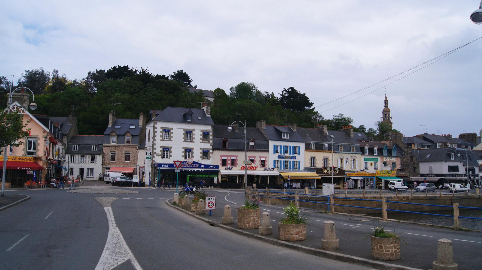
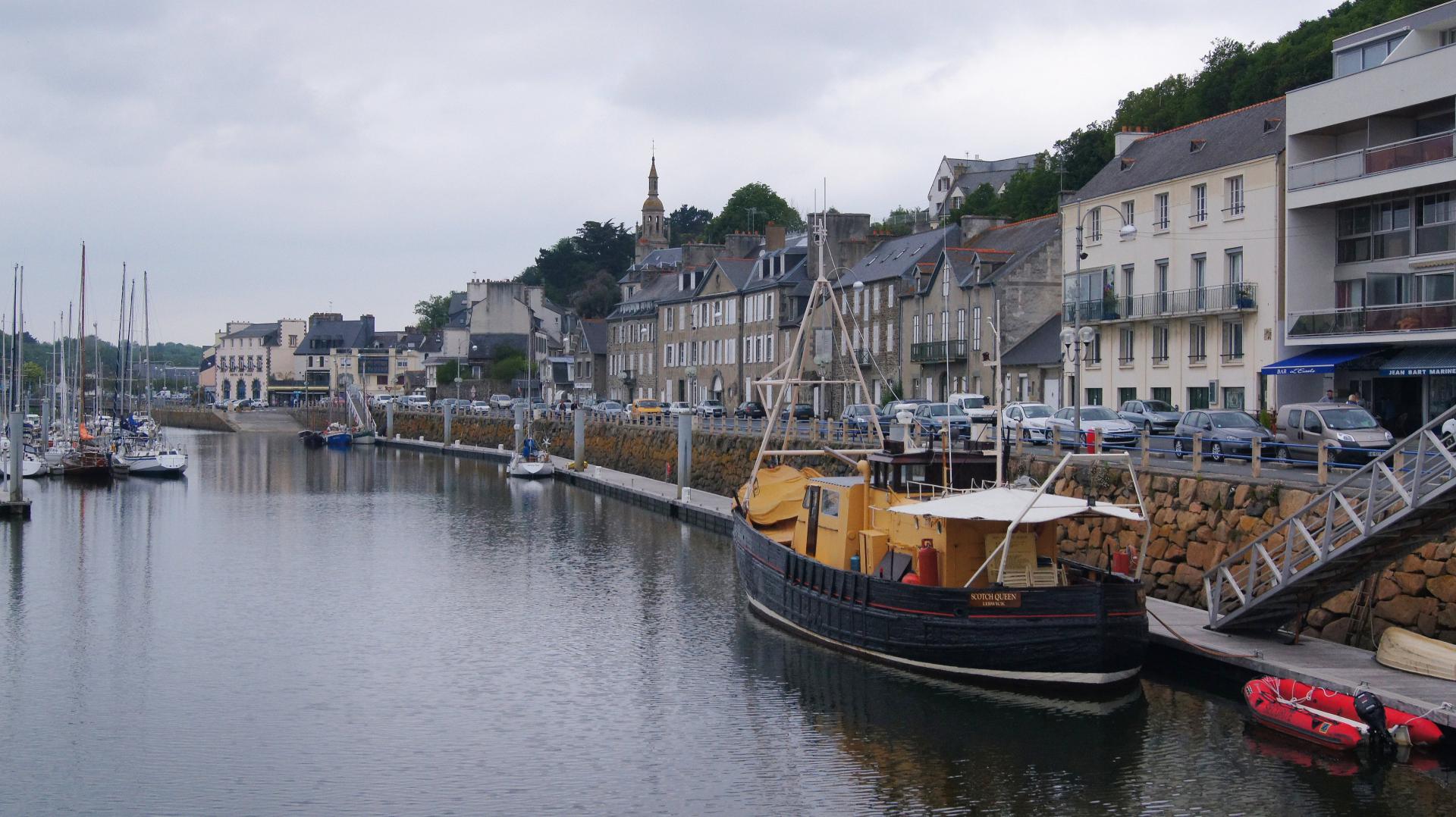
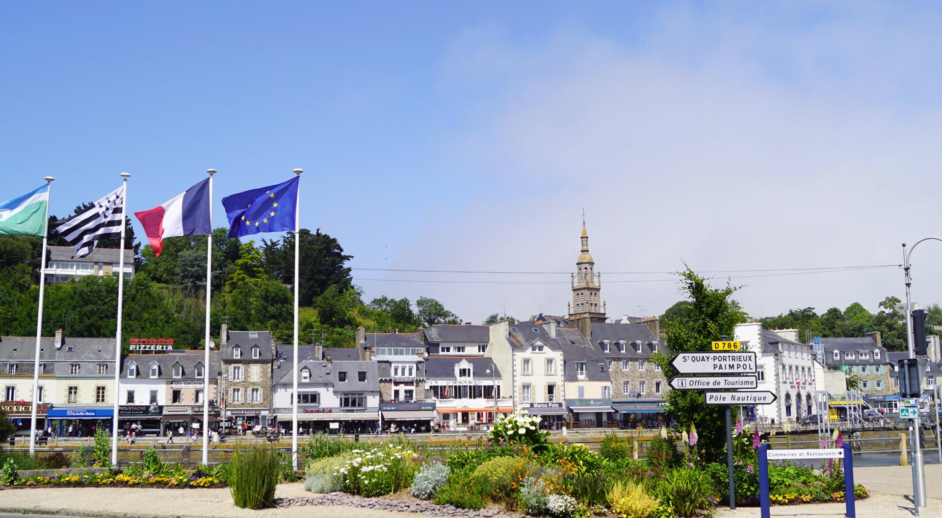
Ville littorale dans la Baie de Saint Brieuc sur la Côte de Goëlo
GARE MARITIME - ferry terminal
-
CLUB, STATION NAUTIQUE - nautical club, water sports centre
Club nautique de Binic, sur le port
Pôle nautique Sud Goëlo 02 96 73 38 45
PLAGE - beach
À Binic :
Plage de La Banche
Plage de l’avant-port
Plage du Corps de Garde
À Étables-sur-Mer :
Plage du Vau Chaperon
Plage des Godelins
Plage du Moulin
PORT DE PLAISANCE DE... - marina of...
ACCÈS ET ESCALE - access and stop
![]()
Navigation :
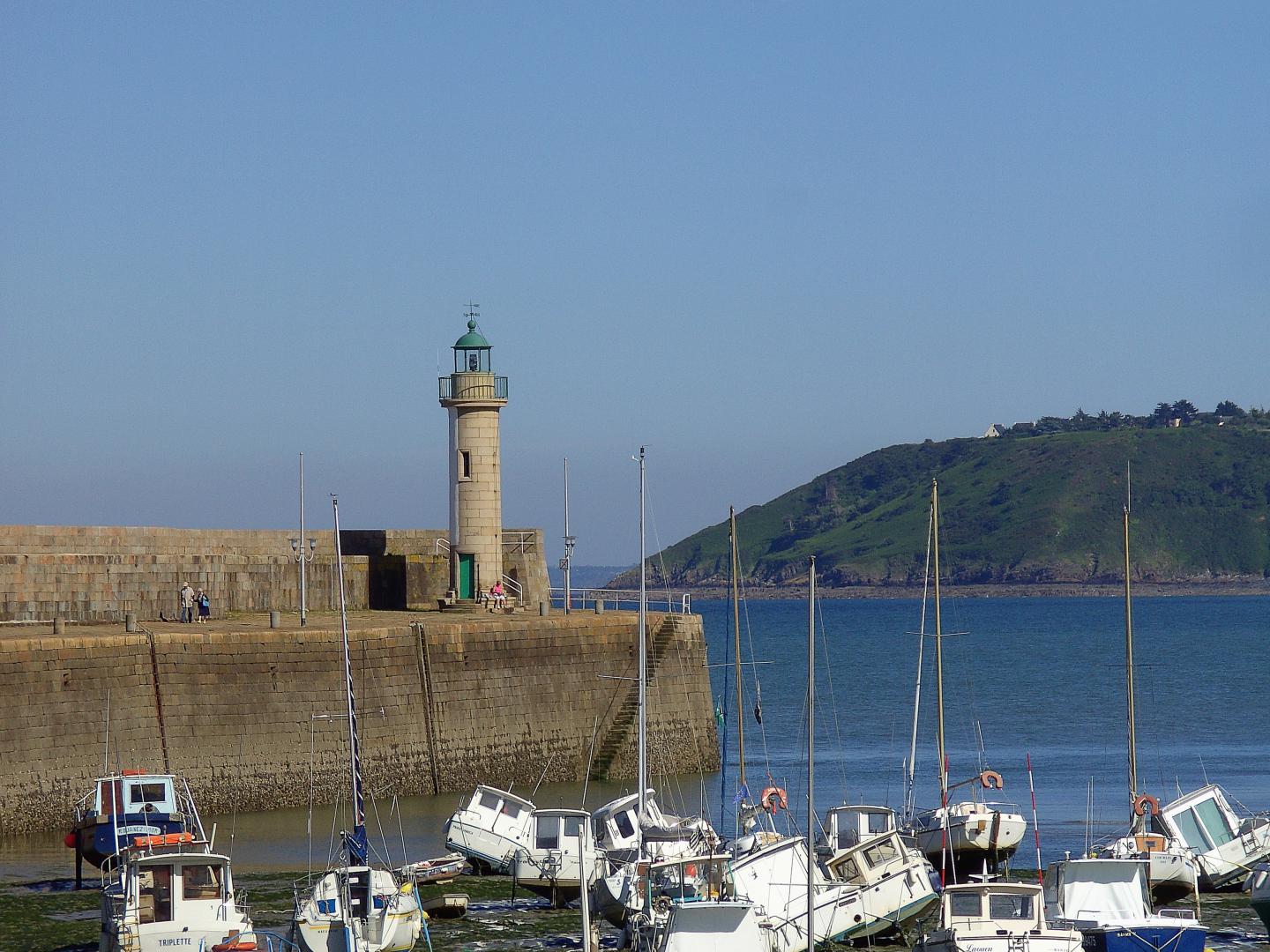
En approchant de Binic, alignez simplement la flèche de l’église de Binic avec la lumière au bout du mur du port - orientée à 275°. Le premier point de passage se trouve à 48 ° 45' N et 02° 38' SO. Il est situé à un mille marin à l’EST du Grand Léjon.
Ensuite suivre le vrai cap 200° pour arriver au 2ème point d’atterrissage à 48 ° 36' 10 - 02 ° 43 ’40 W
Pour entrer dans le port :
Les visiteurs doivent contacter le bureau du port à l’avance par VHF 9 ou par téléphone au 02 96 73 61 86 pour être conseillés.
Table des marées à jour conseillés
Profondeur :
Avant-port, échouage
Avant-port accessible dès la mi-marée
Bassin à flot 1,50 m à 3,00 m
Hauteur à Basse Mer : < ____ m
Tirant d'eau : < ____ m
Tirant d'air : < ____ m
Port à marée : oui - non
Accès bateaux mâtés : oui - non
*Porte : oui - si accès aux bassins
![]()
Navigation :
Approaching Binic, simply align Binic's church spire with the light on the end of the harbour wall - bearing 275°. The first waypoint is at 48° 45' N and 02° 38' SW. Which is located one nautical mile EAST of Grand Léjon, after this follow true heading 200° to second waypoint at 48° 36' 10 N 02° 43’ 40 W
Entering the harbour :
It is recommended visitors contact the harbour office in advance to be advised VHF Channel 9 or Phone 02 96 73 61 86
Current charts and tide tables advised
Depth :
Outer harbor, beaching
Out-port accessible from mid-tide
Basin afloat 1,50 m to 3,00 m
Height at low water : < ____ m
Draught : < ____ m
Air draught : < ____ m
Port tidal : yes - no
Masted boat access : yes - no
*Gate : yes - if access to harbour basin
![]()
Amarrage - mooring
Places - berths : 405
Longueur maxi - length maxi : < 16,00 m
Largeur maxi - width maxi : < ____ m
![]()
Amarrage - mooring
Places visiteurs - visitor's berths : 50
Longueur maxi - length maxi : < 16,00 m
Largeur maxi - width maxi : < ____ m
![]()
Mouillage - anchorage
Places - berths : ______
Mouillage sur ancre strictement interdit - Anchor strictly forbidden
![]()
Mouillage - anchorage
Places visiteurs - visitor's berths : ______
Mouillage sur ancre strictement interdit - Anchor strictly forbidden
![]()
Echouage - grounding
Places - berths : 166
Avant-port -
![]()
Port à sec - dry ports : oui - yes -/- non - no
Places - berths : ______
râteliers à annexes et ponton sont mis à la disposition des usagers de l’avant-port -
SERVICES AUX PLAISANCIERS - service to boaters
![]()
Eau - water : oui - yes
![]()
Electricité - electricity : oui - yes
![]()
Sanitaires - sanitaries : oui - yes
Accès handicapé - disabled access : oui - yes
![]()
Douche - shower : oui - yes
![]()
Laverie - launderette : oui - yes
bac à linge, sèche-linge
![]()
Poubelle - garbage : oui - yes
Tri - recycling : oui - yes
Récupération de déchets : 02 96 73 61 86
![]()
Bac vaisselle - sink for tableware : oui - yes
![]()
Carburant - fuel station : oui - yes
Station service à 1 km (gazole, super)
![]()
Glace - ice : oui - yes
![]()
-
SERVICES TECHNIQUES - technical service
![]()
Récupération eaux grises - grey water collection : oui - yes
Récupération eaux noires - black water collection : oui - yes
![]()
Récupération huiles usagées - worn oil containers : oui - yes
Pompes à résidus - sludge pump : oui - yes -/- non - no
![]()
Zone technique - technical zone : oui - yes
Aire de carénage - careening area : oui - yes
bateaux < 8,00 m
Accès sur rendez-vous : 02 96 73 61 86 ou port@besurmer.fr
![]()
Grutage, élévateur - crane, hoist : oui - yes
potence de levage de 250 kg maximum sur la cale de la Cloche, face à la mairie
Grue mobile 30 T (chantier naval)
![]()
Ber - cradle : oui - yes -/- non - no
![]()
Travelift - travelift : oui - yes -/- non - no
![]()
Cale de mise à l'eau - slipway : oui - yes
![]()
Magasin d'accastillage - deck equipment : oui - yes
ACCUEIL VISITEURS - visitors welcome
Ponton K1 et K2 du quai Jean Bart, au nord du bassin à tribord en entrant
Vitesse limité à 3 noeuds dans le port - limited speed 3 knots
Heures locales des marées
local tide times
Ville référence ou URL - reference city or URL
Capitainerie
harbourmaster

Phare tribord - starboard lighthouse
Jetée - pier
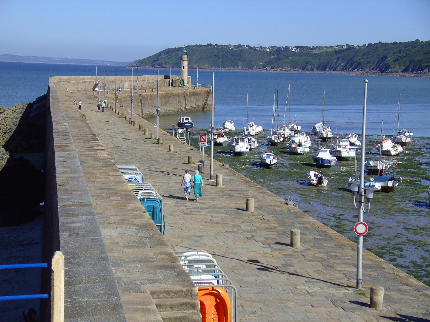
Plage - beach
- upg - 00-000- V03/2018
COMMUNICATION - communication
![]()
NC - nd
![]()
NC - nd
![]()
oui - yes
![]()
oui - yes
Capitainerie
LANGUES PARLÉES - spoken languages
![]()
![]()
![]()
COMMODITÉS - amenities
À proximité,
-
Potence pour P.M.R - jib for disabled
-
MÉTÉO MARINE - weather forecast
-
INFORMATIONS SPÉCIFIQUES - specific information
*Porte :
Bassin à flot doté d'un système de porte dite à bascule. Ouverture de la porte à la marée montante à la cote + 8.80 m par rapport au niveau zéro des cartes marines, fermeture à la cote + 9.00m à la marée descendante.
Lorsque la porte s'ouvre et avant sa fermeture, un fort courant traverse pendant les 20 premières minutes qui suivent son ouverture. Il peut atteindre 5 nœuds lors des grandes marées. Les navires en partance ne doivent pas être en attente près de la porte. Cela pourrait se révéler gênant .
Priorité :
A l'ouverture des portes, les bateaux sortants sont prioritaires. Les bateaux en attente dans l'avant-port doivent stationner le long des quais et dégager le chenal pour laisser les bateaux sortants quitter le port. Les bateaux entrant dans le bassin doivent regagner leur emplacement dès les portes franchies pour ne pas créer d'embouteillage dans le bassin. Les bateaux qui n'ont pas d'emplacement annuel sont invités à accoster au ponton visiteur (à tribord après les portes) puis à se déclarer à la capitainerie
Pont mobile :
Afin de permettre le franchissement du bassin par les piétons et véhicules, un pont mobile est manoeuvré par l'agent de port. Les bateaux souhaitant entrer ou sortir du bassin doivent clairement indiquer à l'agent de port leur intention de passage, pour lui permettre de manoeuvrer le pont. Pour se faire, soit l'usager se présente en attente dans le chenal soit il appelle la capitainerie par VHF sur le canal 9
Courants, attention :
FORTS COURANTS ENTRANTS ET SORTANTS. Juste après l'ouverture de la porte et avant la fermeture de celle-ci, un fort courant peu s'engendrer dans le sas. Nous demandons aux plaisanciers ayant un navire faiblement motorisé d'attendre que le courant entrant s'étale au moment de l'ouverture de la porte. Également, nous vous conseillons de ne pas rentrer au dernier moment car un fort courant sortant peut avoir lieu
*Gate :
Basin afloat with a so-called rocking door system. Opening of the gate at the rising tide at the coast + 8.80 m compared to the level zero of the charts, closing at the coast + 9.00m at the ebb tide.
When the gate opens and before the gate closes, a strong current passes through the gate for the first 20 minutes after the gate is opened, it can be up to 5 KNOTS on Spring Tides. Outbound vessels should NOT standby near gate. It could prove embarrassing.
Priority :
When the doors are opened, the outgoing boats have priority. Boats waiting in the outer harbor must park along the wharves and clear the channel to let outgoing boats leave the harbor. Boats entering the basin must return to their location as soon as the doors are crossed so as not to create bottlenecks in the basin. Boats that do not have an annual location are invited to dock at the visitor's pontoon (starboard after the gates) and then declare themselves at the harbor master's office.
Mobile bridge :
In order to allow the crossing of the basin by the pedestrians and vehicles, a movable bridge is maneuvered by the agent of port. Boats wishing to enter or leave the basin must clearly indicate to the port agent their intention of passage, to allow him to maneuver the bridge. To do so, either the user is waiting in the channel or he calls the captaincy by VHF on channel 9
Currents, warning :
STRONG CURRENT AND OUTGOING. Just after the opening of the door and before the closing of the door, a strong current can engender in the airlock. We ask boaters with a lightly motorized vessel to wait until the incoming current spreads when the door is opened. Also, we advise you not to return at the last moment because a strong outgoing current can take place
AUTRES INFORMATIONS - other information
Ouvert à l'année - open all year : oui - yes -/- non - no
Parking - carpark : oui - yes
Aire de pique-nique - picnic area : oui - yes -/- non - no
Aire de jeux pour enfants - children's playground : oui - yes -/- non - no
Animaux acceptés - accepted pets : oui - yes
Télévision - television set : oui - yes -/- non - no
CONDITIONS D'ACCÈS, CONTACTS, SERVICES, RÉGLEMENTATION - access condition, contact, service, regulation
RÈGLES D'ACCÈS - access rules
Escale payante - stop paying : oui - yes
Attention, les services peuvent être payants - attention, services can be paid
-
CONTACTS - contact
VHF : 9
02 96 74 59 19
port@binic-etables-sur-mer.fr
-
SAUVETAGE - sea rescue
À partir d'un Tél : 196
CROSS Corsen, VHF - 16,
( Manche Ouest - Western Channel )
Tél : 02 98 89 31 31
CAPITAINERIE - harbour office
Quai Jean Bart
02 96 73 61 86
port@besurmer.fr
maitredeport@besurmer.fr
port@binic-etables-sur-mer.fr
RÉGIE DU PORT - administration
-
GESTIONNAIRE - administrator
Mairie de Binic-Étables-sur-Mer 02 96 73 39 90
-
POLICE MARITIME - sea police
Gendarmerie maritime à Saint-Brieuc
02 96 68 30 79
AFFAIRES MARITIMES - maritime affairs
-
DOUANE - custom office
-
- upg - 00-0000

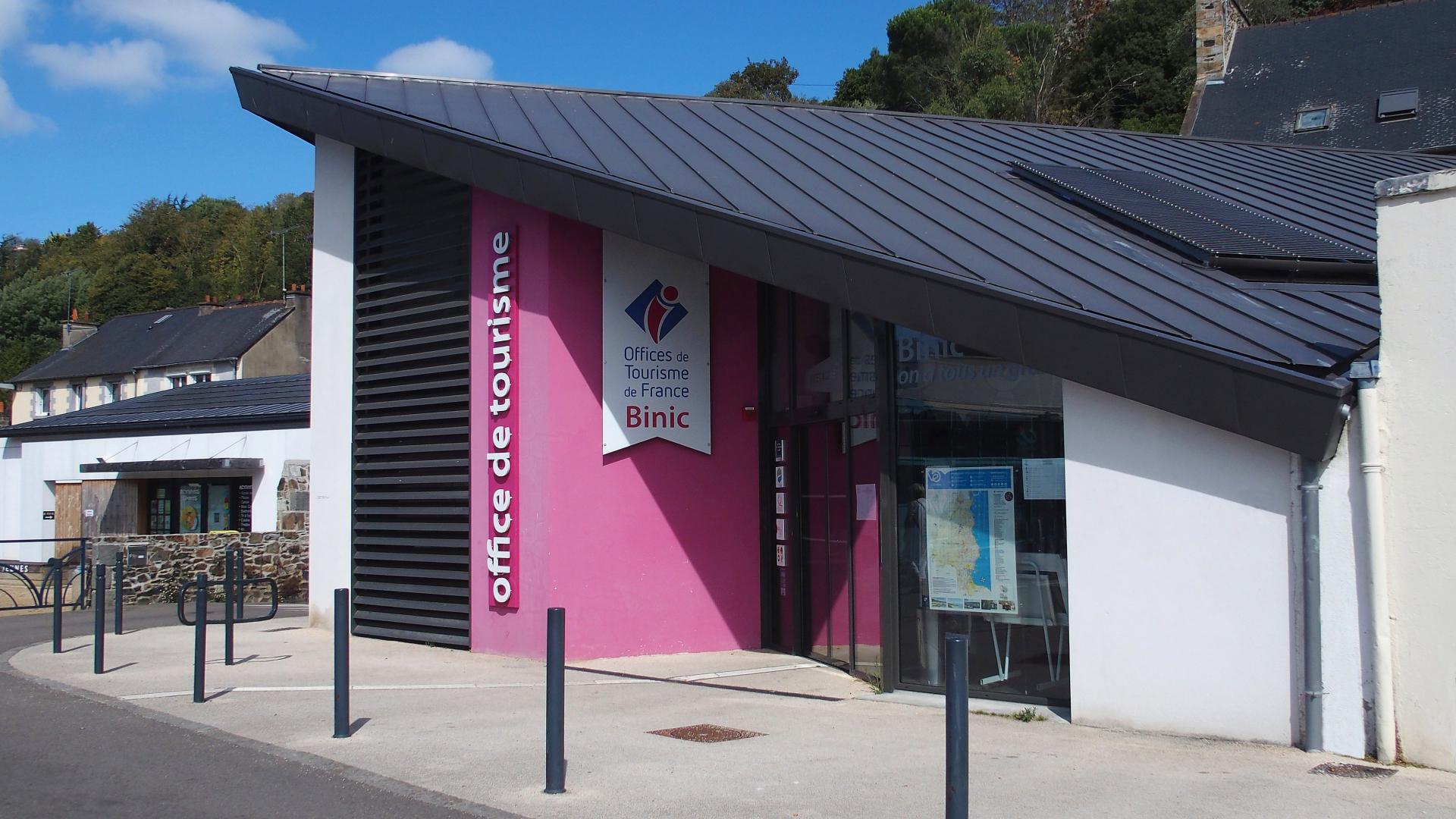
OFFICE DE TOURISME DE BINIC
6 place Le Pomellec - BP 37
Autres points d'information - other information points
Étables sur Mer, 9 Rue de la République
Tél. : 02 96 73 60 12
info@binic-tourisme.com
Contact - contact
https://www.besurmer-tourisme.com
Tél : +33 (0)2 96 73 60 12
info@besurmer-tourisme.com
Fax : +33 (0)2 96 73 60 12
Compléments d'information - additional information
-
Services proposés - services offered
![]()
oui - yes
![]()
NC - nd
Langues parlées - spoken languages
![]()
![]()
![]()
V18 - upg - 00-0000

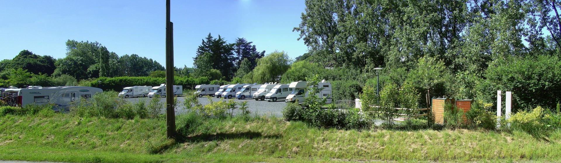
Type d'aire - area :
Communal - communal
Places - number of place :
40
Situation de l'aire - area place :
GPS :
Lat . 48° 36' 02" N - Long.: 02° 50' 07" E
Rue de I'Ic
Lieu du service - service place :
GPS :
00° 00′ 00″ Nord, 0° 00′ 00″ Est
Sur place - on the site
Services proposés - services offered :
![]()
Payant - paying
![]()
Incluse - included
![]()
À l'année - annually
![]()
Incluse - included
![]()
48 H maxi. - maxi.
![]()
Non - no
Informations supplémentaires - additional information :
-
![]()
Information for foreigners - informationen für Ausländer - Informatie voor buitenlanders - Informazioni per gli stranieri - Información para extranjeros - Informações para estrangeiros :
![]()
![]()
![]()
![]()
![]()
![]()
![]()
![]()
Contact - contact
Mairie - town hall :
Tél : +33 (0)0 00 00 00 00
Email :
Office de Tourisme - Tourist Office :
Tél : +33 (0)0 00 00 00 00
Email :
Communication - communication
![]()
---
![]()
---
Autres aires de stationnement à proximité - other parking lots nearby :
Aire privée : SUPER U Les Prés Calans. Espace Commercial, Lat :48° 36' 44" N Long.: 2° 49' 47" E
- upg - 01-2022
![]()
legal notice
contact us
site map
administration
français
english

Concept, Création & Réalisation Webdesigner G.L. - HALTINFO - Modèle, dessin et graphisme déposés - Copyright 2018 ©

